Submitted by: Dan Sellars, Manager, Software Development
Currently in development, CloudUAV is one of the Research Software Platforms funded through the CANARIE Research Software Program. This platform will enable mission planning and data processing for Unmanned Aerial Vehicles (UAVs) in research applications. It is co-developed by the University of Calgary and SensorUp, a Canadian Internet of Things company.
UAVs in modern research
UAVs, often called drones, present some exciting opportunities to modern researchers. The number of applications for UAVs in research is nearly endless, with more and more innovative uses being experimented with all the time (UAVs are even delivering dry-cleaned clothes to customers, if you can believe it). The main advantages of UAVs in research are their low cost, rapid deployment, and unparalleled ability to perform jobs that are the “three Ds”: dull, dirty, and dangerous.
An additional benefit of UAVs is that they are also less invasive than other methods of collecting data. A case in point: Researchers are now using UAVs to count eggs in birds’ nests. Traditionally in this kind of research, someone would have to climb up and count the eggs. This takes a long time and risks disturbing the birds and personal injury to the researcher. With a UAV, the nest is easily accessible with minimal impact to the surrounding ecosystem and birds.
There are many other uses in fields like archaeology, where sites can be surveyed using infrared-equipped UAVs at higher resolution and at much lower cost than with conventional means, such as manned aircraft or satellite. Even assessing the damage caused by looters at archaeological sites is now possible using this technology.
While a great enabler of research and full of commercial opportunities, the use of UAVs is not without its challenges. For instance, Canada and the US have some very stringent regulations from transport authorities on where and how UAVs can fly, due to concerns about public safety and interference with commercial airspace. Such challenges often cause delays in drone flights or adjustments to the drone’s flightpath that may bypass crucial information that could be used for research.
CloudUAV
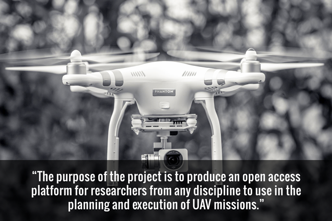
CloudUAV aims to address many of the issues facing researchers when using UAVs. The purpose of the project is to produce an open access platform for researchers from any discipline to use in the planning and execution of UAV missions.
The platform will offer interactive functions that will aid in the creation and planning of UAV missions and workflows, including intelligent filters to allow the avoidance of hazards such as power lines or terrain. As mentioned, local regulators, such as Transport Canada, have a continually evolving set of guidelines for UAV operation. CloudUAV will allow users to search for areas where various categories of UAV can fly and understand Transport Canada restrictions in a given location. This will allow researchers to adjust their UAV’s flight plan for compliance.
Integrated into the platform will be the UAV Data Cloud, a service to remotely store, manage, and pre-process mission data. The platform will also allow users to share results, missions, and flight time. Once complete, it will be available for use via CANARIE’s Research Software Registry for any researcher who needs to use UAVs in their workflow. Researchers in many disciplines will be able to make use of the CloudUAV platform due to its use of open standards and common interfaces, and the simplified workflow and support will enable researchers who have not previously used UAVs to explore adding them to their data-collecting methods.
I hope you have gained some insight to the goals and features of one of our current projects. If you would like some more information about the project, its collaborators, or research mentioned in this article please see the links below:
- The CloudUAV Project: clouduav.ca
- SensorUp: sensorup.com
- CANARIE’s Research Software Portal: science.canarie.ca


